Monday, 8th of June 2009 at 05:43:58 PM

Back from The Wave

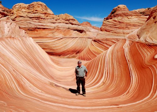
meatwave_500

Me at the Wave Sunday May 31 2009

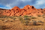
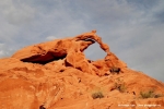
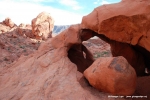
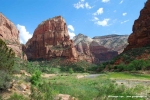
Just returned from my 10 day USA phototrip. Of course the Wave hiking day was the highlight, but I visited some other nice spots too. I will need some time to sort out all the photos and will soon come back with travel log and selected photos. In the meantime check out the photos here.

Related Posts:

Sunday, 21st of June 2009 at 03:57:15 PM

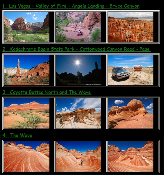
My “The Wave 2009” Phototrip photos are now online

wave2009photopageI am so proud of this series of photos and I still recall great moments of the trip when rewatching them. Unforgettable driving the impassable declared Cottonwood Canyon Road with the Rental 4WD. Or the great Hiking day in the Coyotte  Buttes North where the Wave is located. Here I met Matthias and Bianca Rattay whom I knew well from their fantastic webpage. This was funny cause we hadn’t arranged meeting nor didn’t know each other before. I used to prepare my USA trip mainly with their Webpage. Without meeting them I would have missed all the nice spots beyond “The Wave” and the nice climbing tour towards the hidden Melody Arch. Thanks again to Mathias and Bianca for this nice sunny day. Unforgettable also the nice 8 h Hiking day in the Subway / Zion and the strenous but quick hike to Angels Landing also in Zion. I am still so amazed by my this years phototrip and its the first time i combined roadtripping wth extensive hiking tours. I have recognized that this combination of roadtriping, hiking and photographing is highly addictive to me and I already am catching myself on  coming up with next years phototrip destination. Here you can find my “The Wave 2009”  Photos or follow my Homepage’s link:  Home -> Photos by Trip -> U.S.A. trips -> The Wave 2009.

Still Todo now:  writing my day-by-day travel-log. Coming soon ….

Related Posts:

Sunday, 12th of July 2009 at 02:04:15 PM

Wave 2009 Day 0: Wednesday may 27th 2009

My flight from Munich to Los Angels left 4:30 pm and very soon I remembered what it meant to fly around 10 hours in Economy. Fortunately I had an aisle seat and a very sympathic neighbour: Katarina from Ljubiljana. Some chatting and three movies later we arrived in LAX. I had watched Last chance Harvey with Dustin Hoffmann, The Gifthorse (Hilde) and the Reader. At LAX I had to wait two hours for my connecting flight to Las Vegas, where I arrived really tired at around 12pm. Once again back in Las Vegas which is always a good base for starting my Suthwest trips. Due to the many hotels its always easy to get a cheap accomodation. At McCarran Airport I had to select and pickup my Rental car at the Alamo desk. My choice was a V6 motorized Kia Sportage 4WD. This year was the first time I chose a 4WD due to my planned trips on the Cottonwood Canyon road and to the Wave Hiking trailhead. Another 1h later I dropped into my bed in the Flamingo Hotel on central Strip.

Related Posts:

Sunday, 12th of July 2009 at 03:51:06 PM

Wave 2009 Day 1, Thursday May 28th 2009: Flamingo Pool + Ephemeral Arch

I usually plan my 1st day in Las Vegas with little activity to overcome the Jetlag. Part of this is also some shopping tours to buy stuff for the trip.  I started the day with a nice breakfast at Bellagios Buffet which is my favourite LV Buffet. Afterwards I went to Albertsons to buy an ice chest and plenty of water bottles which I deposited in the trunk. 

Also I bought a mobile phone  at Best Buy for 29 USD including 300 minute calltime. Then I returned to the Flamingo Hotel and spent 4 h sleeping and sun bathing at the Flamingo pool. Late Afternoon around 4.30 pm I drove 70 miles north of Las Vegas to make some evening-sun shots in the Valley of Fire state Park. To warm up I had planned a small beginners hike to visit the Ephmeral arch. Afterwards it proved that this had been a really good idea.  I learned two important hiking basics: 1) Do never forget plenty of water even on a short hike and 2 ) having a GPS with you does not mean you will easily find your target or will not get lost. In fact I forgot to take water with me and I used and practised the first time my new Oregon 300 GPS. I had the short hiking description from Laurent Matres’ book and didn’t find it too easy to discover the right direction from the Cabins car park towards the Ephemaral Arch trail.  Sooner or later I reached the Fire wash and noticed the may sun was still burning hot although it was already around 6pm. I got thirsty but had forgotten the water. Of yourse I did not want to go back to the car. The hike in the sandy wash was exhausting and I was sweating a lot.  I was looking for the Arch. With help of my GPS I approached the location where it should have been. I didnt see the Arch although my GPS said I had reached my destination. I walked another 10 minutes around searching and just when i wanted to give up and go back to the car I spotted the Arch on the right of the wash. The sun was still great for some shots and I was happy not to fail on my first small hike. I had all the time noticed that I would really need to drink some water. I knew it would be around 45 min back to the car. On my way back I had also this first important experience that it is not easy to track back the way in this deserted rocky landscape cause everything looks differnet on the way back. I must admit  that I got a little bit scared of missing the right hill to cross to find back to the car. Fortunately at the intersection of the Fire wash with the hiking trail towards the car park a stone cairn helped me. I arrived totally exhausted and dried out at the car opening my trunk and drinking a bottle of water. It was late evening in the meantime and  my first mini hike had been close to a disaster, scaring, but very instructive fo me. From now on on following hikes I never forgot my water supply and I was warned enough not to overestimate my apparently poor route finding skills.

Related Posts:

Sunday, 12th of July 2009 at 04:33:37 PM

Wave 2009 Day 2, Friday May 29th: The Angels Landing hike at Zion N.P.

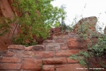
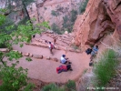
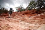
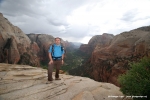
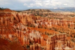
The day started very early at 5.30 a.m. checking out at Flamingo Hotel and taking I-15 north for a 2h45min drive towards Zion N.P. in South Utah. I was really looking forward to this long awaited hike. I had read so much and seen so many nice fotos of this hike. Originally I had planned to do it in my 2008 tour. Unfortunately there was heavy snow back then and I had to postpone. Now the day has come and i was so curious to experience myself how difficult and beautiful this hike is really. I had had no breakfast before arriving in Springdale where I used a refueling stop to have a quick  Mc Donalds cappuccino.I arrived at the Zion N.P. visitor center around 10:30 a.m.Here I took the shuttle bus to The Grotto stop, the trailhead to the Angels Landing hike. The weather was sunny when I crossed the bridge over the Virgin river spotting the first time the Angels Landing. Seen from here it looked really high. I could not imagine how the trail could overcome this altitude so quick, particularly cause the hiking trail was yet not visible. After a long left curve the ascent came to view leading steep to the refrigerator canyon. Hiking along the canyon I reached soon Walters Wiggels, a  steep zig-zag serpentine trail. They helped quickly overcome altitude and the first viewing area Scout Lookout was now near. I first thought havin arrived already on Angels Landing, cause the view from here into the valley was already awesome. Looking to the left I noticed that Angels Landing was still some 30 minutes ahead, another steep hike along a chain. Unfortuantely the weather had worsen during the ascent, big clouds were announcing rain. So I enjoyed the views from Scout lookout only shortly and continued along the chain towards Angels Landing plateau. It was around noon time already and many people where on the way to and from the plateau, so it got sometimes narrow at the chain and the rim hike. When I reached the Angels Landing plateau I made plenty of photos and then the rain began and urged all hikers to climb back to Scout Lookout. The Hike down to the Grotto shuttle stop was easy. Down at the Vigin river the weather had again changed, sun was back again and the clouds had disappeared. It was 3 pm now and my plan was to do some sunset photos at Bryce Canyon where I had booked a night at the historical Ruby’s Inn. After 2 h drive and a photo session at sunset point I had a very nice steak dinner with red wine at Ruby’s Inn. I went to bed early.

Related Posts: