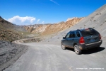
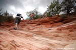
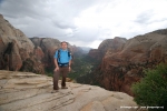
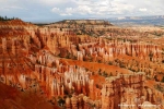
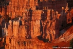
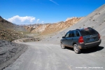
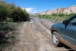
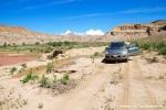
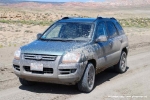
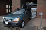
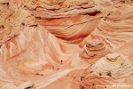
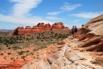
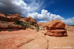
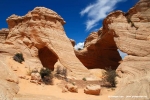
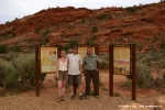
My flight from Munich to Los Angels left 4:30 pm and very soon I remembered what it meant to fly around 10 hours in Economy. Fortunately I had an aisle seat and a very sympathic neighbour: Katarina from Ljubiljana. Some chatting and three movies later we arrived in LAX. I had watched Last chance Harvey with Dustin Hoffmann, The Gifthorse (Hilde) and the Reader. At LAX I had to wait two hours for my connecting flight to Las Vegas, where I arrived really tired at around 12pm. Once again back in Las Vegas which is always a good base for starting my Suthwest trips. Due to the many hotels its always easy to get a cheap accomodation. At McCarran Airport I had to select and pickup my Rental car at the Alamo desk. My choice was a V6 motorized Kia Sportage 4WD. This year was the first time I chose a 4WD due to my planned trips on the Cottonwood Canyon road and to the Wave Hiking trailhead. Another 1h later I dropped into my bed in the Flamingo Hotel on central Strip.
|
|||
|
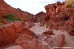
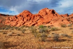
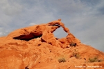
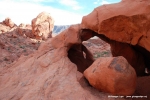
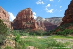
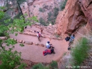
I usually plan my 1st day in Las Vegas with little activity to overcome the Jetlag. Part of this is also some shopping tours to buy stuff for the trip. I started the day with a nice breakfast at Bellagios Buffet which is my favourite LV Buffet. Afterwards I went to Albertsons to buy an ice chest and plenty of water bottles which I deposited in the trunk. Also I bought a mobile phone at Best Buy for 29 USD including 300 minute calltime. Then I returned to the Flamingo Hotel and spent 4 h sleeping and sun bathing at the Flamingo pool. Late Afternoon around 4.30 pm I drove 70 miles north of Las Vegas to make some evening-sun shots in the Valley of Fire state Park. To warm up I had planned a small beginners hike to visit the Ephmeral arch. Afterwards it proved that this had been a really good idea. I learned two important hiking basics: 1) Do never forget plenty of water even on a short hike and 2 ) having a GPS with you does not mean you will easily find your target or will not get lost. In fact I forgot to take water with me and I used and practised the first time my new Oregon 300 GPS. I had the short hiking description from Laurent Matres’ book and didn’t find it too easy to discover the right direction from the Cabins car park towards the Ephemaral Arch trail. Sooner or later I reached the Fire wash and noticed the may sun was still burning hot although it was already around 6pm. I got thirsty but had forgotten the water. Of yourse I did not want to go back to the car. The hike in the sandy wash was exhausting and I was sweating a lot. I was looking for the Arch. With help of my GPS I approached the location where it should have been. I didnt see the Arch although my GPS said I had reached my destination. I walked another 10 minutes around searching and just when i wanted to give up and go back to the car I spotted the Arch on the right of the wash. The sun was still great for some shots and I was happy not to fail on my first small hike. I had all the time noticed that I would really need to drink some water. I knew it would be around 45 min back to the car. On my way back I had also this first important experience that it is not easy to track back the way in this deserted rocky landscape cause everything looks differnet on the way back. I must admit that I got a little bit scared of missing the right hill to cross to find back to the car. Fortunately at the intersection of the Fire wash with the hiking trail towards the car park a stone cairn helped me. I arrived totally exhausted and dried out at the car opening my trunk and drinking a bottle of water. It was late evening in the meantime and my first mini hike had been close to a disaster, scaring, but very instructive fo me. From now on on following hikes I never forgot my water supply and I was warned enough not to overestimate my apparently poor route finding skills.Related Posts:The day started very early at 5.30 a.m. checking out at Flamingo Hotel and taking I-15 north for a 2h45min drive towards Zion N.P. in South Utah. I was really looking forward to this long awaited hike. I had read so much and seen so many nice fotos of this hike. Originally I had planned to do it in my 2008 tour. Unfortunately there was heavy snow back then and I had to postpone. Now the day has come and i was so curious to experience myself how difficult and beautiful this hike is really. I had had no breakfast before arriving in Springdale where I used a refueling stop to have a quick Mc Donalds cappuccino.I arrived at the Zion N.P. visitor center around 10:30 a.m.Here I took the shuttle bus to The Grotto stop, the trailhead to the Angels Landing hike. The weather was sunny when I crossed the bridge over the Virgin river spotting the first time the Angels Landing. Seen from here it looked really high. I could not imagine how the trail could overcome this altitude so quick, particularly cause the hiking trail was yet not visible. After a long left curve the ascent came to view leading steep to the refrigerator canyon. Hiking along the canyon I reached soon Walters Wiggels, a steep zig-zag serpentine trail. They helped quickly overcome altitude and the first viewing area Scout Lookout was now near. I first thought havin arrived already on Angels Landing, cause the view from here into the valley was already awesome. Looking to the left I noticed that Angels Landing was still some 30 minutes ahead, another steep hike along a chain. Unfortuantely the weather had worsen during the ascent, big clouds were announcing rain. So I enjoyed the views from Scout lookout only shortly and continued along the chain towards Angels Landing plateau. It was around noon time already and many people where on the way to and from the plateau, so it got sometimes narrow at the chain and the rim hike. When I reached the Angels Landing plateau I made plenty of photos and then the rain began and urged all hikers to climb back to Scout Lookout. The Hike down to the Grotto shuttle stop was easy. Down at the Vigin river the weather had again changed, sun was back again and the clouds had disappeared. It was 3 pm now and my plan was to do some sunset photos at Bryce Canyon where I had booked a night at the historical Ruby’s Inn. After 2 h drive and a photo session at sunset point I had a very nice steak dinner with red wine at Ruby’s Inn. I went to bed early. Related Posts:This was a unforgetable horror day. The day which almost abruptly could have ended my whole phototrip. The day where I would have become aware that I would not see the Wave. The day where I would have been stuck in the muddy and impassable declared Cottonwood Canyon road. I still wonder how I managed to make it despite my lacking experience in Off-Road driving. But lets see in chronological order. The day started early at 5 a.m. cause I wanted to do some sunset shots of the Bryce Canyon. I checked out at Ruby’s Inn and then I had to wait some minutes in my car with air condition at max. heat to free my windscreen from the ice. It was really cold in this altitude of almost 8000 feet ( 2400m) and I regreted the first (and only) time having only T-Shirts and no coat nor pullover with me. I arrived at Bryce Canyon Sunrise Point and made a nice shot of two deers on the rim of the morning-sun-lit bryce hoodoos. Then my plan was to take the Cottonwood Canyon (CWC) Road, a Dirt Road which is often used as short cut to reach from Bryce to Page and Lake Powell or vice versa. Beside this I had read in USA web forums the road is handled as awesome scenic byway which alone therefore is worth driving it. I had not read much about road conditions, just that it is advisable to ask at some ranger station for the conditions which might vary a lot. From Bryce Canyon towards the Cottonwood Canyon Road the Kodachrome Basin Statepark invites for a short visit and as it was early in the morning I decided to give this park a try. I liked the different chimney rocks and made some photos. Exiting the park I stopped at the visitor center to ask for the CWC road conditions and the ranger told me that he has no information but he had seen some cars driving in this morning. He said I could try it but warned me that it had rained a lott the past days and there may be mud. I had been so eager during planing to integrate the Cottonwood Canyon Road on my trip, and I had herefore booked the 4WD Rental and there were so many sights to see here that I would reluctantly resign on taking this dirt road. I decided to give it a try. The CWC road started right near the Kodachrome Basin State Park and I stopped at the tourist sign to check for any notes. The road itself looked dry and driveable. But after approx. one mile a wash crossed the road and the main road was visibly impassable. But there were car tracks going down at the right and through a mudhole which still seemed impassable to me. But the tracks led into the mudhole and therefore I believed it should be passible. I took all my courage and accelerated the Kia Sportage downhill with full speed through the mudhole. I had a big adrenalin rush cause the car was immediately slowed down in the mudhole with a big bang, mud was sputtering around and I noticed how the car got slower and slower. Luckily the mudhole was not very long, so I could free the car with further accelerating and countersteering the curling car . I stopped after passing the mudhole to breathe deeply. I believed that I had passed the worst and continued my drive. That mudhole was also a good reason to not turn back. Who knows if I would have made it another time. At this moment I did not know that I would be confronted with another 5 mudholes, one worse the other, especially one long-stretched mudhole where I still wonder how I managed to not get stuck. But now after this first fright I was targeting the Grossvenor Arch, a beautiful rock formation at the north end of the CWC road. I had no big troubles arriving there, just some cowboys with a big cattle herd made me stop to let them pass northwards on the CWCR. At the Grossvenor Arch the light conditions were not optimal (evening location), I still spent some 15 minutes for taking several shots. Then I continued south on CWCR. I liked driving the dirtroad were the road conditions were not too bad, and I enjoyed having this adventurous 4WD experience. But soon enough I came over the other mudholes waiting for me. Everytime arriving at a mudhole I stopped and had a look at the situation and then went back to the car and accelerated full speed through the mud. Everytime I had a big adrenalin rush and got more and more scared. It was now when I began to evaluated the possibilities. I did not want to go back cause I knew there were mudholes. I did not know was what was in front of me, did it get worse or had i already passed the worst. I frequently monitored my odometer to see how many miles remained from the 40 miles of CWCR lenth to reach the safe Us89 Hywy. One time I arrived at a deep waterhole in the road where I did not want to drive into. But I manged to pass this by climbing the road shoulder and passing the watered road on the shoulder. Then around midway of the CWCR, 20 miles before reaching the US89 I arrived at a long-stretched mudhole which did not look so bad as it than showed up. I stopped, checked, got short breathing and trembling and took all my courage to accelerate at full speed. Mud was spraying everywhere, the wheels began to slip, the car got slower and slower and was jumping from left to right when I accelerated. The mudhole did not end and I got slower and slower. I was practically already stuck and was already sure thats it with this vacation. I somehow still did not remove my foot from the accelerator although I was almost stalled. I think the circumstance and luck of having a V6 motor saved me here. I stayed with my foot on the gas pedal and slowly slowly the car continued from the almost stop through the spluttering mud. I got less deeper mud and the car got more power to the wheels winding slowly thorugh the mud, me countersteering every left and right jump. Finally a big left jump of the car when I apparently got more solid ground under the wheels and a final countersteering and me already seeing the car cant over. I stopped when I was free, trembling and screed to death. Now around 20 miles north of US89 it was for sure, there is no return. Never ever would I drive through that mudhole again. I now monitored the odometer constantly mile by mile still stopping with unwell feeling here and there for photo-shots. I could not enjoy that drive nor the awesome landscapes. There were no more big obstacles and I arrived 1 hour later at US89 turning right to visit the BLM ranger station to check the road conditions. Arriving at the rangerstation the Ranger seeing my car asked me if I had come down CWCR. I affirmed and I was not surprised when he showed me on his roadcondition table that the CWCR is declared as impassable. He told me this happens around 2-3 times a year but it has long not been so bad like on this May 30th 2009. I always thought weather is fantastic in May / June in this area and learned this is an incorrect assumption. I was so happy to having made it, that I was not really sad having renouced on the planed stops at the Yellow Rock and checking the way towards the White Rimrocks. It was for sure now that I had to renounce on this trips I had planned around the CWCR. In the evening I checked in at my Hotel in Page the Marriot Coutyard. It was cloudy but I still went to Horseshoe Bend to check the location for some morning shots and then I did some shopping in Page’s Walmart. Finally I drove through a car wash to free the Kia Sportage from the Mud. It had been little bit embarassing parking with its mud at the Marriot for the check-in.Related Posts:Sunday was the big day. This was the day of my Wave Permit. I got up early at 5:30 am and arrived around 7 a.m. at the Wirepass trailhead. After registering to the visitor logbook I noticed I was the first on the trail. With the very good Trail description from the BLM it was easy to find my way through the wash to the first orientation point and then towards the twin buttes. The more I approached the Wave the more beautiful the landscapes got. I began to wonder how this unreal beauty could really be natural. I was not hurrying and spent lots of time for photographing, knowing that I was early and the Wave would anyway be best for photographing not before 10 a.m. My plan was to visit the Lace Rocks before reachinbg the Wave. Herefore I needed to leave the trail to the wave at a wash and climb a hill on my right. Right before arriving at the wash I noticed two other hikers approaching me. From the far I could recognize that I knew those two hikers: Bianca and Matthias Rattay whos informative Travellogs I was following since a while . Indeed I had used mainly their travel reports to get inspired for my own trips. I like reading their website cause they have really tough trips and I learned from them how much can be seen in very short time. Sometimes I get the impression they manage to do in a day what I plan to do in two days. This often inspires me to toughen up my own program too. Following their online travel reports I knew their faces and I knew also that they would be at the Wave in May, like me. In was a poor lucky coincidence meeting them here right at this day. They were little bit surprised when I was greeting them in German by their names and I presented myself. We chatted a little bit and I asked if they would go up to the Lace rocks too. They denied but Matthias showed me how to find my way along the wash. They had been around 5 times in the Coyotte Buttes North and and therefore knew the area pretty good. Unfortuantely our ways splitted here and I was sad not having had them as hiking pals for this day. Perhaps we would meet later at the Wave. I climbed up the hill to the Lace rocks and the sun was already burning hot although it was just around 9 a.m. At the top of the hill I found those filigrane stone formations named Lace rocks and made some shots. Climbing down again towards the main trail I noticed a Coyotte running down the hill. I was surprised to see the animal so close to me ignoring my presence. Down at the wash again I followed the instructions and trail towards the Wave, where I arrived at around 10 am. There was a pool on the main entrance and I did yet not know that the main wave known from the photos lied behind that pool. Soon other hikers arrived and we managed to pass the pool and go to the main axis of the wave. It is an unbelievable experience seeing the Wave the first time and soon I started shooting from different angles and with different settings. Around 1h later I decided to continue my hike and try to find my way to the top rock , melody arch and other sights nearby. I climbed the hill on the left side behind the main wave and followed my GPS. Soon I noticed I was reaching a point where it got to dangerous and steep to continue climbing. I gave up and returned having a nice view down to the wave and the other hikers. Only 20 persons get a permit each day and around 9 persons were visible at the main wave from above. Most of the hikers visit only the wave and then return back. I was beginning to believe that my high aims of visiting all these other locations I had read about in travelreports would be condemned to remain plans. Then I spotted Bianca and Matthias from above arriving down in the Wave and doing some shots. I immediately raised hope that they would visit those other spots I knew also from their travelreports and I sped up my climb down to the Wave. I reached them when they already had left the Wave and were themselves climbing up towards my location. I did not hesitate to ask them if I could join them telling them that I got lost up there and did not find the right way towards Big Mac, Melody Arch etc. They told me that they had been at the Boneyard meanwhile and they did not mind if I would join them. This must be my lucky day! I met two Germans who had been already 5 times at the Wave and knew how to reach all those hidden secret spots. I couldn’t imagine better guides then Matthias and Bianca. they showed me everything: The Bee (Mosquito) whos nozzle had vanished meantime, the Big Mac Rock. They encouraged me to climb the steep wall to the melody arch (which I would never had adventured myself), the melody arch and the window, nice views to brain rocks and also a visit to the alcove on the top rock which is visible from down at the wave. Later of course down again the pools and the Second Wave. I enjoyed so much hiking with Bianca and Matthias and was impressed by their pace, courage and sense of direction. The whole afternoon clouds had accumulated in the sky and arranged a nice setup for our photos. Sometimes we feared a thunderstorm but soon enough weather cleared up again. At the second Wave the cloud presence seemed to increase again so that we understood it would note make sense to wait for the evening sun iluminating the second Wave. We retunred after many photos at around 5 pm and again I was impressed by Mathias’ and Biancas pace. I was tired, my back was aching and I felt my heavy equipment, whereas Bianca and Matthias hiked back towards the car with quite a high pace so I was automatically dragged along with them.We arrived around 6 pm at the Wire Pass trailhead and after some drink and chat we made a souvenir photo of us three at the WP trailhead sign. We arranged to meet two hours later in Page to have dinner together in a mexican restaurant. Once again thanks to you both! I hope one day we manage to hike again together. I really enjoyed that day. Related Posts: |


