Sunday, 13th of June 2010 at 06:11:55 PM

The Herzogstand - Heimgarten Hike 2010

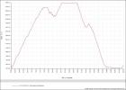
Last year I was in bad shape it took me 7 1/2 hours for the whole hike. Kind of alarming. This year I have improved again. 1 1/2 hour to Herzogstand, 1 hour on the rim and 2 h descent and finally 1 hour back to the car. In total 5 1/2 hour, … back to normal!

Related Posts:

Monday, 13th of June 2011 at 01:58:37 PM

my lifesaver: GPSmap 62s

Happy to have had the Garmin GPS with me. Several times I would have been lost without it. After not having been too happy with the Oregon 300 this year I used the GPSmap 62s. This one is fantastic. Highly Recommend!!! Great contrast. Easy to use. Long runtime.

Related Posts:

Friday, 5th of August 2011 at 05:18:38 PM

The Herzogstand – Heimgarten Hike 2011

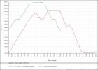
After my hikes on my GSNM phototrip in may/june this was my first long home hike in 2011. Like every year I hike the Herzogstand to Heimgarten rim loop starting in Urfeld.  A total of 20km (12.5 miles) and a summed elevation difference of 1376 m (4500 feet) in climbing.This year it took me 2h from Urfeld to Herzogstand peak, 1h on the rim from Herzogstand to Heimgarten 2 hours down to Walchensee village and finally another hour back along the Walchensee lake back to the car park. This time I had exactly tracked the Hike on the GPS to compare it with one of the more strenous hikes in USA, the Observation point hike. Doing those hikes in US I never could really rank how difficult they were. The Observation point hike in Zion N.P. was with 4h quite short but the one I had the most elevation difference. I was surprised when comparing the GPX tracks that the summed height difference there was only 780 meter (2560 feet).. In both hikes my pace was quite high being in good shape this year. Hope this gpx and screen logs will motivate me in the coming years to keep the pace and shape.

here my 2011 GPX track of the Herzogstand-Heimgarten loop hike

Related Posts:
Sunday, 7th of October 2012 at 08:14:40 PM

Herzogstand Heimgarten Hike 2012

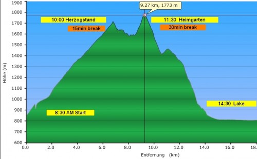
Like every year I hiked the Herzogstand Heimgarten loop hike, my favourite home hike. I started 6.45 from home and arrived at 7.50 at the parking lot near Urfeld. Exactly at 8.00 I began my hike towards the first mountain which is Herzogstand (1731 m). This is the most exhausting part of the hike cause its a steep uphike over 2 hours. Arrived there at 10.00 am. After short break continued over the rim towards Heimgarten Peak (1790 m). This is the most beautiful part of the hike with amazing views into the Alps in the south and the lakeland in the north, as well as to Lake Kochelsee and Lake Walchensee right to ones feet. Due to socalled  “Foehn” winds the visibility was extraordinary. The next part of the hike is an endless long downclimb from Heimgarten peak (1790 m) to the Lake Walchesee level (800 m). Finaly a nice last 5 km walk along the lake back to the car park for a total of 20 km hiking distance.

Get the Flash Player to see the wordTube Media Player.

Google Earth tour over my hiked gpx track.

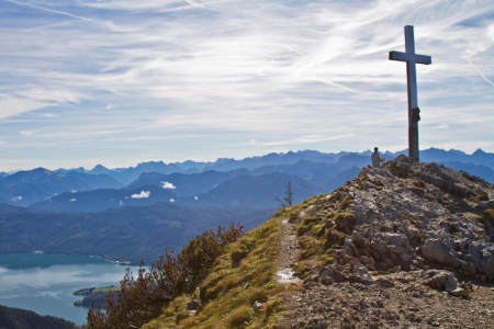
Arriving at Heimgarten peak (1790 m) at noon. View to the north into the alps with the Lake Walchensee beneath.


Related Posts: