Wednesday, 13th of June 2012 at 08:27:14 AM

Y.S.N.P. 2012 day 11: Rainbow Bridge

6.00 AM I checked out at Escalante’s Prospector Inn and my plan was to move to my next basecamp: Page in Arizona. I wanted to drive the Cottonwood Canyon Road a scenic 47 mile dirt road connecting US12 in Cannonville with US89 Highway. I had driven this road several times and loved its variety of landscapes. I found it in perfect condition even for 2WD car and thus it was pure focuse on the landscapes without any challenge due to road condition. I had driven this road already once in 2009 when it hat been declared unpassable due to mud. I am always remebered again at that scary situation when driving here. But this time of year road was really in a fantastic shape, easier to drive than Hole in the Rock Gravel Road. Unfortunatly I was early and shadows present, thus it made no sense to do any fotos.

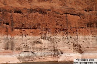
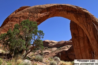
I checked in at my hotel in Page, Az at 11am and drove then to Whaweap Marina, where I had booked a boattrip to the Rainbow Natural Bridge .The boat started 12.30 in plain sun, so I hide myself in the lower deck. We arrived at 2.30pm at the Natural Bridge, which is reachable through a 1/4 mile hike from the boat dock. Unfortunately sun was still standing high and contrast to extreme for fotos.

On the boattour back to Whaweap Marina I stayed on the upper sun deck and enjoyed the amazing views of the Lake Powell and the sandstone formations. This kind of boat tour is the best way to see Lake Powell from close distance.

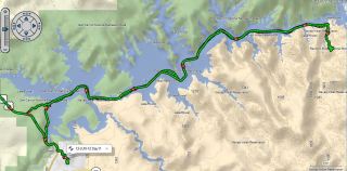
In the evening I met my friend Alex from Munich and his friend Yang from Phoenix, Az. We planed our comen hiking tour for the next day having diner at Dam Bar & Grille. Here GPS log of the boat tour:

Related Posts:

Thursday, 14th of June 2012 at 03:59:00 AM

Y.S.N.P. 2012 day 12: The Wave

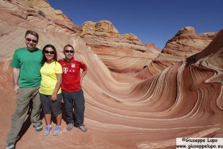
My friend Alex had won 3 Permits for hiking the Wave in the Coyote Buttes North, in the Vermillion Cliffs National Monument for June 13th. Unfortunately one of his hiking Pals was not able to attend the hike as planed. Being in US at the same time (I had this year delayed my trip to June, in order to visit Yellowstone N.P.) he asked me if I want to join. That was an easy and quick decision, of course The Wave is always worth a hike, even if I had done that hike in 2009 and 2011 already. We had a pleasant day together although the June sun was not good to us. It qas poor coincidence that on the morning we ampeared in traffic light colored hiking shirts.

The evening we had dinner together in Page’s “Dam Bar and Grille”. A nice day.


Related Posts:

Friday, 15th of June 2012 at 06:19:57 AM

Y.S.N.M. 2012 day 13: Bucksin Gulch

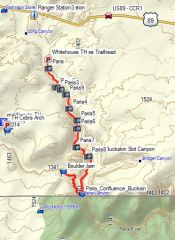
The Bucksin Gulch is one of the deepest and longest Slot Canyons. The only way to visit is either a more day hiking tour  or for day hikes through access from either Wirepass or Whitehouse Trailheads. To see the deeper and narrower sections I wanted to enter through Whitehouse trailhead. There the Paria River is accessible and leads after 7 miles to the Bucksin which merges here into Paria river. In June both streams have no water so hiking is possible. At the confluence I planed to go upstream in Bucksin Gulch for 2 miles.

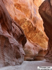
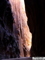
It was a long hike (total of 28km or 17 miles roundtrip). I started at 6.30 am Utah time at the Whitehouse trailhead and reached at 10.15 am the confluence of Bucksin into Paria, only there a little water was still present. Then I walked 2 miles approx. upstream to the Boulder Jam location where I had a break and then returned back to the carpark at the Whitehouse Trailhead where I was back at 2.50 pm. I had kept a high pace to not walk for very long in the hot june sun. The first foto shows the Paria Slot Canyon and the second the Bucksin, both close to the Confluence.

Related Posts:

Sunday, 17th of June 2012 at 07:26:36 AM

Y.S.N.P 2012 day 14: Left Fork of the North Creek Canyon Hike

This was the last day of my foto roadtrip 2012. I wanted to close it with a classic hike which physically challenges me and which was on the way back to Las Vegas. The Hike of the “Left Fork of the North Creek” Canyon in the Zion Kolob Reservoir

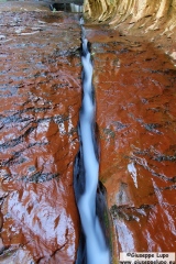
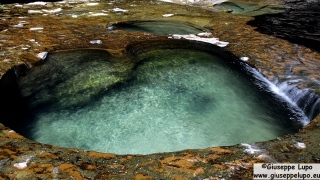
is known to be a strenous hike due to its character of a obstackle course hike with need to permanently cross the creek, climb over rocks and hills and cascades. Roundtrip it was only 10 miles /15 km length but had a steep descend at  the trailhead and climb on the way back. I had done this hike before and thus knew what to expect. It is in located in the Zion wildernis area and requires a permit which I had picked the day before at the Zion Visitor Center. Thus I could start the hike early being at 6.45 am at the trailhead. At the trail end this hike offers a tube like grotto where pod holes filled with blue shimmering water and several cascades  offer foto oportunities. The hike in the early morning was very enjoyable. The June air was still cool. I saw around 15 frogs on the way crossing my path. I arrived at 10.30 am having spent some 45 minutes with fotographing a Crack filled with water passing at high speed in it and several cascades. But the sun was yet not up so the fotos were not nice. At the trailhead on the other side the sun light had already entered the grotto and thus there too no good fotos could be made. I stayed for around 90 minutes and then returned in the hot June sun in a lovely but exhausting hike. Working through the bushes I scrathed arms, legs and my head. Some bittersweet short-dated souvenirs from my trip. I was back at the car park at 3.30 pm from where I drove back to Las Vegas checking in to my Hotel at 7 pm.

Related Posts:

Tuesday, 19th of June 2012 at 10:22:23 AM

Y.S.N.P 2012 day 15+16: San Francisco

My friends Maurice and Alex from Munich lived and worked since two years in San Francisco.

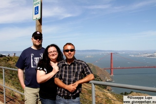
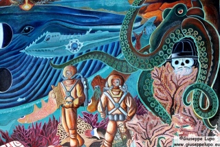
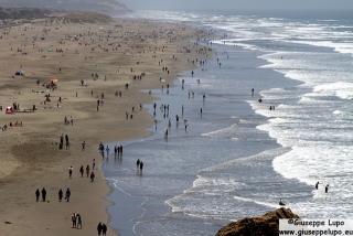
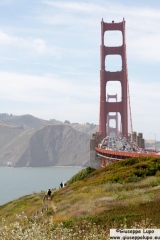
I finally wanted to visit them on this US trip. I arrived 9.20 am with a morning flight from Las Vegas at the SFO airport where Maurice and Alex picked me up and we drove directly to Bernal Heights for a first amazing city view and afterwards we had breakfast in a diner in the Mission district. Saturday became a wonderful hot June sunday. We walked around in the Mission district and Alex and Maurice showed me the mural paintings which are typical for this district. I really liked those and made many fotos. Afterwards we drove to the Castro district where they showed me where they had lived for some month. Herefter we went to Lands end viewpoint and visited the old sutro bath ruins. Then we drove to a Polish butcher to buy breakfast suasages 🙂 (really). Afterwards we drove to a Fort Point, an excellent vievpoint for the Golden Gate Bridge. Finally we drove over the Golden Gate Bridge to the Muir Beach Overlook with amazing vistas on the californian coastline. We had a hot lovely June saturday, according Alex and Maurice  one of the first really hot ones this year. We all got sunburned. The next stop before driving back over the golden Gate bridge was the Marin Headlands viewpoint to the Golden Gate bridge. It was the viewpoint I liked the most of all because it centered the whole Golden Gate in front of the City skyline. After crossing Golden Gate bridge we stopped immediately for another amazing view onto the Golden Gate bridge. Then we drove to downtown to Chinatown. After walking some sidestreets and visiting a fortune cookie factory we went for diner in the House of Nanking. Sunday after breakfast we watched the Germany-Danmark Euro soccer match. In the afternoon I took the ferry to San Francisco downtown and walked around in Embacadero-Ferry Building-Maarket Street-Union Square-F-Line to Fishermans Warf and finally took the Bart to SFO Airport to fly back to Las Vegas.

Related Posts: