Tuesday, 24th of May 2011 at 08:26:30 AM

GSENM 2011 day 5: Roadtripping Day

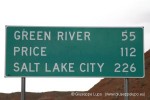
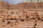
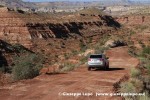
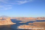
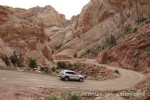
Today the rain probability had been forecasted to be 50% in Escalante region. At 7.30 when the BLM Ranger station opened I asked the Rangers advice and they recomended not to hike in the Slot Canyons due to high risk for flashfloods after rain. Therefor I had to cancel my planed Neon Canyon Hike and decided to start my transit to my next basecamp which is Moab (Utah) immediately. My plan was to drive via the Burr trail which is a scenic drive on a partially dirt road. I had enough time and prefered this route compared to the freeway. The weather forecast proved correct: when entering the dirt road part heavy rain began. I was little bit scared the road condition could degrade but luckily all went smooth, I liked especially the long switchbacks down to Long Canyon. The Burrtrail lead me towards Lake Powell and the small recreation area of the Bullfrog basin. I relaxed little bit in Lake Powell where the weather was sunny again. Then I continued my trip in North Eastern direction towards Hanksville with a short stop at the Little Egypt geological site. In my pevious USA trips the Roadtrip part had been always the dominating part. The fascination for the Hikes came later. Therefore this day remembered me a lot to my previous USA trips where I passed a lot of time in the rental car. North of Hanksville another short stop to visit the Goblin Valley State Park. Another heavy storm in the afternoon when I was drivng the US24 towards Greenriver with amazing clouds and fantastic light allowed some nice shots.
I arrived in Moab at around 6pm and using the rest of the evening to inspect the foto locations for my next day visit of the Arches N.P. At last I checked out some Motels and ended up in a mini suite with two rooms and kitchen. I will stay two nights in Moab…. (to be continued)

Related Posts:

Wednesday, 25th of May 2011 at 07:55:09 AM

GSENM 2011 day 6: Arches till you drop

A whole day in the Arches N.P. near Moab
morning:
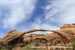
-Devils Garden hike 5h. with Landscape Arch, Double O Arch, etc.
afternoon:
-Windows Section of Arches N.P.
evening:
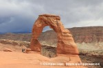
– Delicate Arch Hike 1h
– 4h at Delicate Arch untill sunset


Will be updated after my return.

Related Posts:

Thursday, 26th of May 2011 at 07:55:23 AM

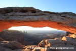
GSENM 2011 day 7: glowing Mesa Arch

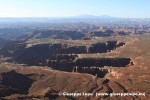
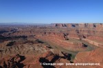
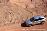
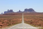
Today I wanted to shot the sunrise at Canyonlands Mesa Arch. According my GPS the sunrise was at 6:02 Utah Mountain time. At 4.00 am my alarm clock waked me out of my dreams. At 4:17 I was on the road towards Canyonlands N.P., a 1h drive from my Motel. From the trailhead it was a 15 minutes walk to the Mesa arch. At 5.30 around 6 photographers were waiting for the sunrise.After this fascinating event I shot some photos at Canyonlands N.P. main Viewpoint and then I drove around 20 miles east to the Dead Horse State Park for some fotos of the Colorado River overlook. I then decided to have some fun with my rental car and drive back to Moab via the Shafer Trail and Potash Road.This is a rough dirtroad with bumps, ruts, drop-offs and lot of dust. Instead of 1h along the regular roads this drive took me 3h but was good fun.Back in Moab I began my transfer to my next basecamp: Page, Arizona at the Lake Powell. Here I plan to stay four nights and continue to visit the Grand Staircase Escalante Nationalparks Southern Part. The drive itself was long and unspecacular. I liked the small town of Monticello and of course the Monument Valley were I stopped only short. I arrived in Page at around 6pm. It was not too easy to find a Motel, cause I learned this weekend is Memorial Day.

Related Posts:

Friday, 27th of May 2011 at 07:16:27 AM

GSENM 2011 day 8: Bucksin Gulch

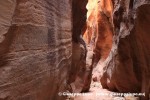
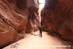
In the morning I participated with 61 other tourists at the Wave Lottery in the BLM Ranger Station on US89. 10 permits per day are assigned via this lottery. I was unlucky. After the lottery I anyhow drove to the trailhead of the Wave. Its the Wirepass trailhead 5 miles south of US89 on House Rock Valley Road. It is a dirtroad wich was in good condition, beside many bumps and some ruts. The Wirepass trailhead is also start point for the hike thorugh Wirepass Slot Canyon to the Bucksin Gulch is the longest and deepest slot canyon in the Southwest, and while others are narrower, prettier or more challenging to explore, the length and variety of the terrain in the gulch make it the best overall.
My plan was to hike into the first mile of the Bucksin Gulch and do some shots. Due to the high walls and darkness it was necessary o use a tripod and it cost me lot of time. The rest of the day I explored to dirtroads for the next planed hikes: Whapweap Hoodoo dirtroad braching of Cottonwood Canyon roaf and the Long Valley Road to the middleroute trailhead, starpoint for the 3h hike to the Cobra Arch. I returned at 7pm to the Motel for diner.

Related Posts:

Saturday, 28th of May 2011 at 08:45:44 AM

GSENM 2011 day 9: Bingo

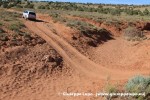
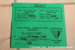
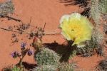
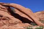
This day begins again at 4.00 am. I wanted to capture the Whaweap hoodos, a early morning/sunrise location. I had seen them often in Internet fotos, and wanted to see them myself for a while already now. The problem is that they are quite difficult to access. Either a 3 mile uphill hike or access over a difficult dirtroad with approx. 1h drive time. I choose the second option and had studied the dirtroad the evening before. I arrived in time to make some good shots and then I headed back the same way to the BLM Ranger station to participate a second time at the Wave lottery. I arrived 5 minutes before the draw started and the luck was on my side this day. As last of ten day permits my No. 35 was drawn and I received a Permit for visiting the Coyotte Buttes North area were the Wave is located. . After the lottery I drove again like the day before on the Lone Valley dirtroad to the 45 min away trailhead of the Cobra Arch hike.This dirtroad had a washed out part near its end and required to drive on the road shoulder in deep sand. It was until now the most difficult drive I encountered on this trip. I arrived at around 10.15 am on the trailhead and it took me 1h hiking in the hot sun. It has began to get hotter in the last two days, and the hike was very strenous. During my hikes in the desert I had noticed that there are many wildflowers blooming right now. Perhaps also a sign that the winter and rainy time had just ended and thus it was a good choosen time for hiking having the possibility to see all the desert in bloom and the manifold of wildflowers. I had fotographed many and plan to create a own webalbum for them. This yellow cactus flower was a rare one. I found perfect light condition for some shots and returned at 12.30 at the trailhead. Another 45 minutes late I was back on US89. I decided to drive back to Page and refresh in the pool. . At the evening at 4 pm I started another long dirt road drive, this time branching of in Big Water from US89 towards Alstrom Point, a fantastic sunset viewpoint into Lake Powell. Around 20 miles on this dirtroad took me around 1h one way and I arrived in time for the photos. (The last 1/2 mile I walked cause the road condition was absolutely critical with big ledges. I was back in the Motel at 8 pm and after a shower went to DAMs Grill for a good American Burger. This was one of the most succesful days: 3 great photo location under best light condition and as a cream topping the win of the wave permit. Tomorrow is wave day….my second time.

Related Posts: